We left
Whitehorse, but with a very short drive ahead of us. We went as far as Takhini
Hot Springs. This is a beautiful private campground, with
electricity only, but they have a dump station and fresh water fill-up.
 |
| A beautiful wide site, with lots of privacy |
The
staff are friendly and very helpful, and the grounds are beautifully kept with sites are carved out of the forest and are well separated. After choosing our
site and eating, we went up to the hot springs.
 |
| Entrance with a Cafe attached |
This one is a very large
concrete pool, with the hot spring water coming in at one end- the hot shallow
end- then through a gate into water 1.7m deep with a shallow end in a much
larger section- with outlets at this end to the natural stream outside the
fence.
 |
| The closest end is the hottest |
It was delightful, to just lie in the water, paddle around and move from
cooler to warmer and back again! There were people there of all ages, young
babies, toddlers, quite a number of kids having fun, all ages right up to the
white-haired crowd.
 |
| Everyone had to follow the rules, especially No Snowballs! |
When we
got back, the campground police came knocking! Our Nova Scotia friends were
there waiting for a part for their truck. We had a great visit and catch-up
before they left the next morning to get it fixed.
It rained the
next day, and John felt miserable, so, we stayed an extra day and just hung out
in the trailer. We couldn’t do much with the Internet as it was really
weak.
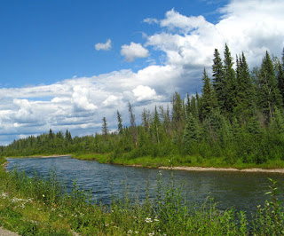
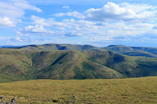
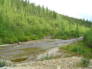
We began our
trip North towards Dawson City, stopping first “on the marge of Lake Laberge”.
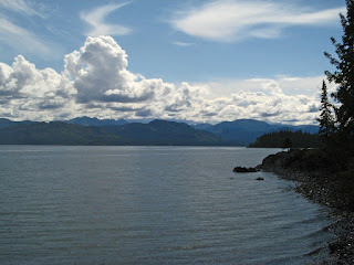 |
| The Marge of Lake Leberge |
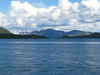 |
| View across Lake Leberge |
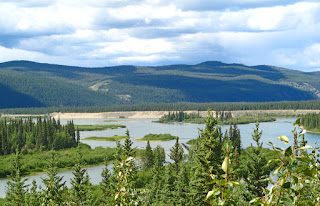
 |
| 30 Mile Heritage River |
It was a bumpy dirt road, but we had to see the site of the Cremation of Sam
McGee.
We had decided
to stop at Twin Lakes Territorial Park,
 |
| Formation of Twin Lakes |
and when we got there, Christina and
Paul had already arrived. We had a beautiful large site up on a hill
overlooking the lake.
 |
| The view from the hill behind our trailer |
Actually it was a double site, but the Park was not busy,
so we did not have anyone else come in.
The park was really pretty, with sites
of all sizes, but well separated and level. We enjoyed another campfire at
their site and were joined by a lady from Colorado. She raved about a Territorial Park up in Mayo, on the way to Dawson. She said it was much prettier
even than Twin Lakes. So The four of us decided to go up there for the next
night, before carrying on to Dawson City.
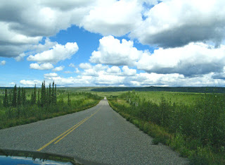
The next day
was a bumpy green day!
 |
| rounded hills |
 |
| Montague Road House |
 |
| There was a roadhouse every 30-40km |
We drove over three separate areas of road construction,
6km and 8 km and on only a few hundred feet, and lots of frost –heaved bumps
and pot holes! There were several spectacular views of the rivers,
 |
| We drove into what was once Beringia |
 |
| Pelly Crossing Bridge over Pelly River |
but the
drive was mainly through green fir trees and aspen. It was generally flat with
some mountains in the distance. The road up to Mayo had several sections under construction [what else is new !].
 |
| More muddy roads |
When we got to Mayo to the Five Mile Lake
Campground, Christina and Paul were already there. The campground was beautiful
with wide sites well separated, but there were no sites on the lake,
and we
couldn’t even see it, unless we walked up the road. It was a narrow lake, with a gravel beach and
swimming area.
 |
| A narrow 5 Mile Lake the next morning |
Several children were enjoying a raft near the shore when we arrived. However, it certainly
did not rival Twin Lakes or Muncho Lake Park.
The next day
dawned bright and clear. We took a quick drive into the town of Mayo before we
left. There is not much there, but they have developed a beautiful lookout and
small park above the river with spectacular views of the area.
 |
| View from The Mayo Gazebo |
 |
| Stewart River |
We drove right
to Dawson City. It was a rather ordinary day of driving, once we got back on
the Klondike highway, broken only by gravel patches.
 |
| Our truck and trailer looked just as muddy |
One section we drove km
without a pilot car, but with graders and rollers on half of the highway. We
finally had a pilot car for the last few kilometres. The terrain was fairly
flat, with rolling, domed green large hills.
 |
| Fairly flat |
 |
| Some domed green hills |
 |
| Often beside the Stewart River |
We drove right to the Klondike River Territorial Campground, another beautiful, well maintained campground.
 |
| Lots of room for a bonfire and chairs |
We met Cristina and Paul, and later after dinner
at the Greek restaurant,
 |
| Our first meal in Dawson City |
we decided to take the ferry
 |
| Looking back to Dawson City from the ferry |
to West Dawson
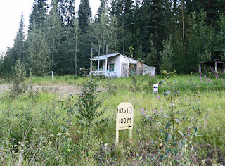 |
| We don't really think this is the Hostel, but maybe.... |
 |
| The Moosehide Slide |
 |
| The explanation... |
to check out the other government campsite. T
hen we drove up to the top of the Dome Road to get a view
of the whole area.
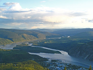 |
| The Stewart and Yukon Rivers |
 |
| Dawson City |
 |
| and the road back down... |
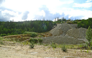
As you drive
towards the city, you are welcomed
and then you see high, long curved mounds of gravel.
 |
| The tailings |
 |
| The explanation... |
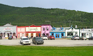
These are all
tailings from the dredges. This whole are had been mined for gold. This is a
picturesque town, of 1998 people (according to the guidebook- no kidding). It
has the look and feel of an old frontier town, streets are wide,
 |
| Front Street |
and the
brightly coloured stores have a frontier appearance. Front Street, along the
Yukon River, is paved with white asphalt,
 |
| Front Street on the Yukon River |
while all the others are dirt roads with wooden sidewalks.
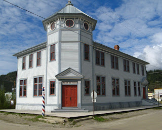
There are a lot of historic buildings, some fixed up and in use,
 |
| Bunk House apartment |
and some needing to be renovated,
 |
| One of the next to be renovated?? |
and many of which are not open to the public. We found out that
many are Government Historic Sites and are open at certain times of the day
only, or only opened on one of the many walks with a tour guide. We learned to
plan our day around when buildings are open or a walk is happening.
But some have explanations,
and some houses are beautiful private homes.
The folks at
the Visitors Centre were very helpful, and interesting. There was a water hose
out back, that we could just drive up to and use. We filled our 6 gallon
container several times and our trailer before we left. The wifi however was
iffy. Macs, iPhones, and iPads connected with no problem, but the signal was
weak, but my PC would not recognize the network after the first day. I was trying to connect at the Visitors' Centre while John toured the Keno National Historic site. The Keno, an 130-foot riverboat built in 1922 in Whitehorse, was the last steamer to run the Yukon River from Whitehorse in 1960.
 |
| Galley |
 |
| Passenger cabins |
Later, we finally went to the Library to use their wifi.
 |
| Elementary School with the Library attached [on right] |
There were only Four places to get wifi,
the Visitors Centre, the Library which was connected to the Elementary school,
the Yukon College and one coffee house.
 |
| Alchemy Cafe -excellent lunches- with rooms at the back |
Unfortunately, one Monday we wanted
wifi and, both the college and the coffee shop were closed Monday's.
There was so
much to see and do, we were busy every day- not that we started out very early,
because evening lasted until after midnight almost every day! The sun was
setting about 12:05 or so each night and it really felt like the “Land of the
Midnight Sun”. John’s axe got a real workout as we had fires most nights.
We walked the
streets several times, as we toured various buildings. There was the beautiful Palace Grand Theatre.
 |
| The Lobby with bar |
 |
| The Theatre stage |
 |
| and backdrop |
This is used once a year for a grand revue for the town, for the annual
Music Festival and by Parks Canada in the summer. It is magnificent, and has
been restored to 1937.
The Bank, the
Saloon
 |
| The Saloon, and our guide on an evening walk |
and Post Office
 |
| The original Post Office |
are three of the buildings we saw on our evening guided
tour. They are not open to the public, but appear just as they would have
during the gold rush!
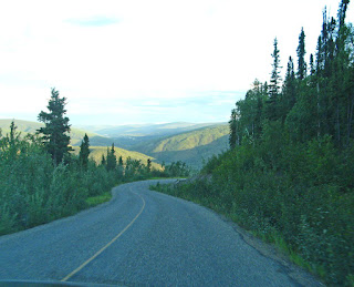
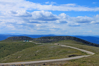
One day we
drove to the Top of the World highway. We crossed the Yukon River, on the barge.
It will carry about 9 cars or trucks, or one big Class A, and a couple
of cars! The line-up is usually long, particularly the first weekend we were
there as it was the Music Festival. We drove to the end of the road on the
Canadian side, overlooking the Canadian US border.
 |
| The Border |
Christina and Paul were
camping up there for the night, and we drove up to see it and have dinner with
them. It was an incredible drive. You feel as if there is no one else around
for most of the drive. The road goes across the tops and around some of the
higher mountains in the range.
The views are spectacular.
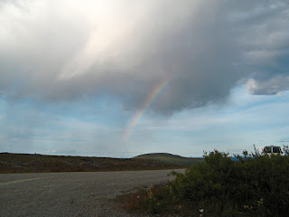 |
| Even a rainbow right at the top! |
 |
| One view south |
We saw a heard of
caribou off in the distance, a couple of hills away. Then on our drive back,
because the Border was closed, and we were the only car on the road, the
caribou came right to and across the road.
We saw about 5 herds as we wound our
way back. They ran beside us along the meadow and crossed in front or behind
us. They are quite skittish though, and would not come too close.
One evening we
all went to Diamond Gertie's Gambling Hall for the 8:30 show.
 |
| Diamond Tooth Gertie's Gambling Hall |
This is actually a casino with
a floor show. We got there early, but there were no seats on the floor except
way at the back, so we sat up in the balcony on the side. It was a great show
of song and dance!
 |
| Gertie sang |
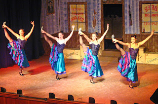 |
| The dancers |
 |
| Gertie and the Dancers came out at the end for photos |
We enjoyed it so much, we stayed for the 10 pm show too, but
decided not to see the midnight show! It was great fun!
We toured
Robert Service’s cabin,
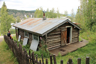 |
| View from the back hill |
 |
| Robert Service |
 |
| The bedroom |
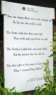 |
| The opening of The Cremation of Sam McGee |
and had an interesting presentation
 |
| Presentation Cabin |
at Jack London’s
cabin. This cabin has been moved here. Only the bottom half of the original cabin, that he lived in in 1897, was used in this cabin, The logs from the top half are in a replica in Jack London Square in Oakland, CA.
 |
| Sod roof on Jack London's cabin |
Pierre Berton’s house has a plaque on it, but it is a private residence for Dawson’s Writer in Residence each year. It is a more modern bungalow.


There are all
kinds of shops, only a few are touristy. There is a great bakery, but you have
to get there early, several great jewellery stores with local artists work and
gold nugget jewellery, a couple of grocery stores in original buildings,
several boutiques, a home hardware, and a couple of banks. There are a variety
of restaurants from Chinese and Greek to Klondike Kate's.
I did not get
a chance to Pan for gold, but we did drive out to Dredge #4, one of the
original dredges used during gold mining.
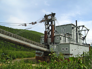 |
| Back view |
 |
| Front view |
We found out how the huge arcs of
tailings are formed- the buckets
 |
| Dredge #4's buckets |
on the front work in an arc digging from the
top down, feeding the material into the inside of the dredge where it is tumbled,
and moved along a series
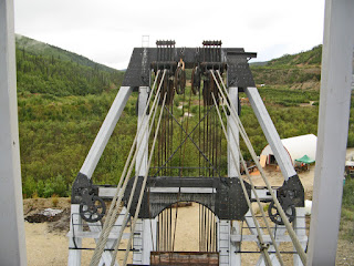 |
| what the operator sees, but with the bucket on the front |
of drums and
belts to separate the gold,
 |
| The final filters |
until only the waste gravel is thrown out
30ft from the back. These are huge machines! We saw several smaller mining sites.
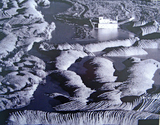 |
| View of tailings from the air |
 |
| A Claim being worked today |
Then we drove up Bonanza Creek
 |
| Bonanza Creek today |
to see the first claim, the Discovery Claim, at Bonanza Creek.
There is an interesting Discovery Trail to follow.
 |
| The Red Chairs... |
 |
| Tailings from Bonanza Creek |
 |
| Gold Flakes |
One of our
last visits was over the river, and up to the Golf Course lookout. We got a
beautiful view of Dawson City.
 |
| The confluence of the Klondike and Yukon Rivers |
And the confluence of the Klondike and Yukon
rivers. Then we drove into the campground on this side of the Yukon River, to
see the paddle-wheelers graveyard. We parked at the end of the park, and
followed the beach
to the wrecks of not one, but at least four boats.
They are
all twisted together. A sad sight!
We moved to the Bonanza Gold Campground nearer to town for the last night so we could fill with water, dump black and grey water, and do laundry. We registered, then drove into Dawson for the last time, to see the Commissioner's Residence
 |
| The Residence |
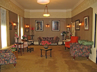 |
| Drawing Room |
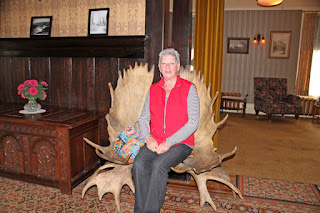 |
| Moose Antler chair in the front hall |
and the Dawson City Museum
This was a city we were very sorry to have to leave. We loved our time here, even if it did rain some part of every day!


No comments:
Post a Comment