Travelling south on the Cassiar from Meziadin, the
highway was in good shape, but there was some resurfacing being done, and we
had to wait for the pilot car. John got out, and noticed a trail of water. A
stone on the newly chip-sealed section of the road had sheared off the drain
valve of our fresh water tank and all out fresh water was draining out! There
was nothing we could do right then, but a few phone calls to CanAm, and to
dealers in Prince George, and we were good to go. We just had to be sure to
have water hookups until then!
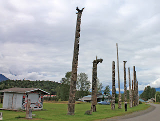
Just before the junction of the
Cassiar and the Yellowhead highways, was a small Indian reserve of Gitwangat,
with a row of some of the finest authentic totem poles in the area.
 |
| Fascinating Totem Poles |
They were
really interesting, many completed,
but some only just started. Just across the
road is St Paul’s Anglican Church with a bell tower beside it housing the
original bell from the 1893 Bell tower.
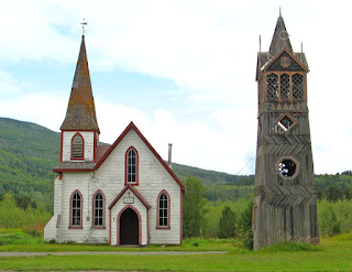 |
| Church and Bell Tower |
 |
| View through the church window |
We drove as far as the town of
Smithers
 |
Smithers Main Street
|
for lunch at Two Sisters, a fabulous little restaurant,
 |
| A wonderful restaurant just off the Main Street |
and a walk
around.
 |
| Top of Main Street |
It was a lovely town, but we decided to go further before we stopped
for the night, so we could be as close to Prince George as possible. We stayed
on Fraser Lake at Pipers Glen Campground. It was a modest little campground
with much to be modest about.
 |
| Pipers Glen - Fraser Lake |
We were up and off early (for us), heading to
FraserWay RV in Prince George.
 |
| Prince George! |
Luckily, it was a fairly easy fix. They put on a
better grade drain. It surprised us that this sticks out at the bottom of the
trailer, and is not protected. The trailer was not ready until late afternoon,
so we decided to stay at the Casino for the night with a dozen other folks.
 |
| Casino parking overnight |
We
ate at the restaurant attached to the hotel, and were able to watch the Blue
Jays game- they won.
We planned to stay at the
Provincial Campground at Mount Robson, but needed to stop one night on the way,
so we could arrive early to get a good site. We stopped for lunch at the little
town of McBride.
This town set up a model Solar System within the town’s boundaries.
 |
| Model Solar System |
The historic train station where we ate lunch, is the Visitor Information Centre and has The Beanery2 Internet Cafe, a café with
all home-made soups and sandwiches.
 |
| Train Station |
We chose to stop here for the night at
Beaverview RV Park and Campground, not even unhitching. We were once again in a
large field but with water and electricity.
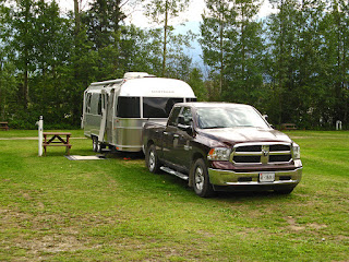 |
| A field, but hookups. |
The next morning we were off again
to the Provincial Park at Mount Robson. On the way we stopped at Rearguard
Falls on the Fraser River.
 |
| Rearguard Falls |
This is the upper limit of the 1300km migration of
Pacific salmon. As we watched, a group piled into 2 rafts and headed off to the
rapids for some fun.
Just before we got to Mount Robson Park, we stopped at Mount
Terry Fox Rest Area, with a beautiful memorial to Terry Fox,
 |
| View over to Mount Terry Fox |
a park and a view
of the mountain named in his honour.
Mount Robson is spectacular, even as we first saw it through
the smoke from the Washington forest fires.
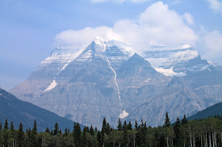 |
| Mount Robson in the smoke |
We found a
beautiful campsite in Mount Robson Provincial Park, Robson Meadows Campground.
We stayed for two nights to see the area. The next day, the smoke cleared
somewhat and we were able to get a clearer view of the mountain.
 |
| Mount Robson without smoke |
 |
| John 's perspective from around the smaller hill |
It is the
highest peak in the Canadian Rockies. Later, John hiked up the smaller mountain
to the east and got a somewhat different view.
We walked down to Overlander Falls. It was a 15 minute
walk, but what they didn’t say was that it was all downhill, often on a
switchback trail.
In 1862, 175 men and one woman travelled overland from
Ontario, heading to the newly discovered goldfields in central BC. The usual
route was around the tip of South America, hence this group was named the
Overlanders.
 |
| The Story... |
 |
| The Falls |
They reached this spot in August 1862.
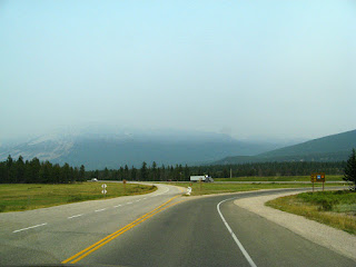
The next day we started toward Jasper. The smoke was so
thick that the vistas were eerie.
 |
| Eerie but Beautiful |
We stopped at the Yellowhead Pass, elevation
3760ft/1146ft, the border between BC and Alberta.
 |
| Park at the Yellowhead Pass |
We drove into Jasper
 |
| The Junction of the Icefields Parkway and the Yellowhead- ringed with mountains!! |
to go to
our favourite coffee house [in the laundromat] for a latte before heading down
the Icefields Parkway towards Calgary. Jasper is ringed with mountains. However
walking around town, you couldn’t see any of them for the smoke.
 |
| The Icefield Parkway south of Jasper |
We stayed for
the night at the Columbia Icefield
Discovery Centre’s huge parking lot,
 |
That is us way off in the smoke!
|
 |
| Here we are! closer - still in smoke though |
across from the Columbia Icefield
which covers 241sq.mi./388 sq.km., and its most visible long finger, the
Athabasca Glacier.
 |
| The glacier used to cover this whole parking lot |
 |
| Terminal Moraine behind the parking lot |
It used to be free overnight parking for RV’s, but now cost
$15.70, the same price as the unserviced National Parks campgrounds. We walked
up to the Centre, but everything was closed, so we just wandered around. John
went out fairly early the next morning to get some pictures of the icefield
before the smoke settled in.
 |
| Part of Columbia Icefield |
 |
| Athabasca Glacier |
The smoke was really bad all the way down, so we
saw some views of some of the glaciers close to the road, and only ghostly
images of some of those which were further away, as we drove beside the Saskatchewan
River.
 |
| The glaciers are dim ghosts |
We even saw several sheep at Big Bend.
The smoke was thick right into
Calgary.
 |
| South Calgary |
In fact we could not even have a fire in the fire pit for the first
week that we were at our son’s house because the air quality was so bad,
outdoor fires were banned.
We had a lovely visit with our grandkids, giving Karen and
Garry a holiday while we looked after them for several days. We spent a lot of
time playing at the local park,
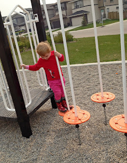 |
| She loves to climb |
 |
| Look at me too! |
and spent a day at Heritage Park.
 |
| "Gasoline Alley" with all the cars was their favourite |
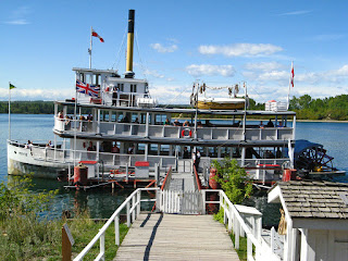 |
| A ride on a riverboat |
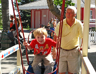 |
| I'm not sure which he like more this swing or |
 |
| the big Ferris Wheel |
 |
| But they both loved the Steam engine train ride- but not the hand stamp! |
We even spent
time at their favourite stores, “Malnart” and Mastermind Toys.
 |
| The wooden trains were the favourite in the store |
The trailer got a good scrubbing inside and out, then we
were on our way again. The first trip took us back to Banff. We had to go down to Ocotocks first to weigh
the trailer, axles and truck, so we took the Black Diamond route to the main
highway.
 |
| A beautiful day and beautiful drive |
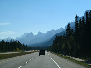
However, we were soon on the Trans Canada and into the mountains.
 |
| Back to the mountains |
We
stayed once again in the Tunnel Mountain Campground in the RV section with full
hookups. The first day was warm and sunny, so we took a trip back to Canmore. The
views were spectacular, but still there was smoke.
 |
| The drive to Canmore |
The bike trail beside the
highway had more traffic than the highway, with folks of all ages enjoying the
beautiful weather. Canmore is such a pretty town
 |
| Entering Canmore- The Three Sisters Mountains |
with interesting buildings.
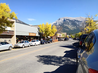 |
| Main Street |
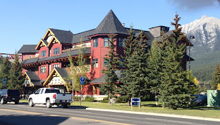 |
| Condos |
 |
| A store on the ground floor |
We
walked all over, and then took the boardwalk trail over the marsh, beside the
river.
 |
| Boardwalk over the marsh |
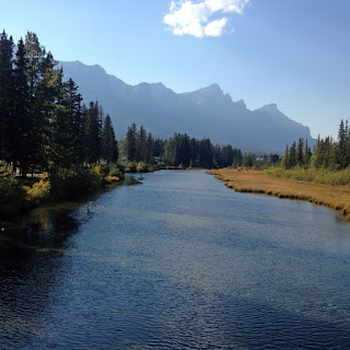 |
| Beside the river |
We crossed a beautiful wooden bridge
 |
| A beautiful wooden bridge |
to a stunning condo complex, with
the Three Sisters Mountains in the
distance,
 |
| An idyllic location for a condo |
before walking back to the truck.
The weather turned a little wet, then cold and we woke up
one morning to snow.
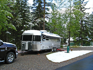 |
| Snow!! |
Out came hats and gloves and an extra layer! We discovered
a section of Banff that we had missed before, to the south end of the City
Centre. We took a walk around the area, and a walk along the river to the Canoe
Club. It was pouring most of the time, but umbrellas worked to keep us fairly
dry- just not our feet!


