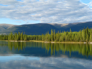
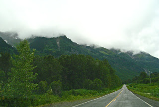
The Cassiar Highway, sometimes called the Stewart-Cassiar Highway runs south from the Alaska Highway, just west of Watson Lake, to the Yellowhead Highway from the BC coast to Edmonton Alberta. The highway begins in the Yukon,
 |
| Our last look at the Yukon |
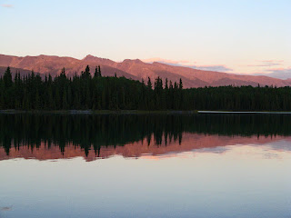
but in 5km you enter British Columbia.
 |
| Entering BC |
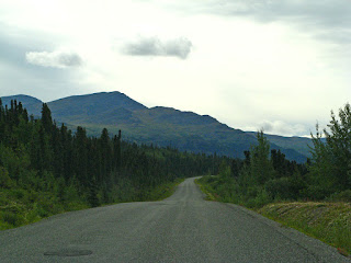
The road initially runs through the Yukon Plateau -flat , forested country-, and through areas of a 2010 forest fire,
 |
Devastating, only underbrush has regrown, and a few small trees in the 5 years
since the fire |
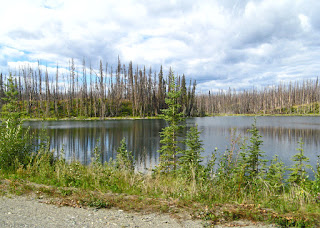 |
| Burn Lake |
started by lightning, that burned more than 30,000 hectares and closed the Cassiar for several days. The highway at the north end is quite narrow, without centre lines or shoulders. The Cassiar Mountains are soon seen in the distance.
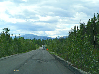 |
| No shoulders, no centre line, flat plateau, but Cassiar Mountains in the distance |
We didn’t drive far, just a short 109km, but stopped for the first night at Boya Lake Provincial Park.
 |
| The Km and miles are measured from the junction with the Yellowhead Highway |
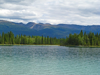 |
| Boya Lake |
The sites were beautiful, many right on the lake. Ours backed onto the lake,
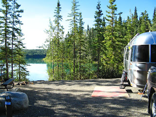 |
| A really large site on the lake, wood ready to be chopped |
and had our own little launching or swimming area.
 |
| Our own little cove |
We again wished we had brought our kayaks. Since we were no longer in the Yukon, there was no free firewood. However, in BC, you can take firewood from one park to another. So we bought a large bin of firewood for $10. John had a grand time splitting it so we could have our campfire. The campground was run by a Park Operator who had been there for 10+ years. She considered this HER campground, and was really proud of it. Sites were raked, washrooms (i.e. pit toilets) were spotless, and NO bears were allowed. She had a “bear dog” from that chased any who came near. We walked around the lake to the day area.
 |
| Standing on the dock... |
 |
| The children's play area, but I took a turn on this unique swing |
It was beautifully calm on the water, and the sun was setting as we sat at our fire.
 |
| Across the lake from the campsite |
Down the road is Jade City,
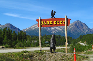 |
| View as you drive South |
population 50 and Cassiar Mountain’s Jade Store.
 |
| These are chunks of jade from the mine |
 |
| and the fascinating store... |
It is not really a city, but a community made up of one jade business that specializes in jade products, and free jade-cutting demonstrations. It has the largest selection of Canadian jade. The family has mined and designed jade since 1972. [It is designed here then sent to China mainly to be cut and finished, before being sent back here to be sold!] About a million pounds of jade are mined per year from the Cassiar Mountains, and about half is exported.
 |
| This jade chair sits in front of the store- beautiful, but not very comfortable... |
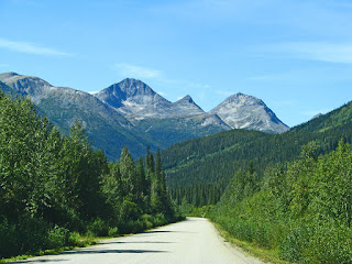
Travelling south we had an excellent view of Needlepoint Mountain,
 |
| Needlepoint Mountain |
 |
| The last of the Cassiar Mountains |
and south to Dease Lake,
 |
| Dease Lake |
the site of an HBC post in 1838, and a boat-building centre during the gold rush. We had run out of propane in one tank, so needed to refill it. We were told that there was propane available at Dease Lake. We drove around and finally found the right place, a house with a large yard and several outbuildings behind it, several kilometres from the highway out by the airport. John got out, looked around and finally knocked on the door of the house, but no one answered. We knew we had one tank of propane left, but with no electrical hookups in any of the local or Provincial Parks, we were going to have to be careful. We decided to stay at the Lions’ Club Tanzilla River Campground, in Dease Lake.
 |
| Tanzilla River |
This is a modest campground with sites cut into trees with some along the river. We almost took a river site until we realized the door would open into a muddy puddle, so we chose a site in the trees.
 |
| Beautiful sites cut into the trees |
There was lots of beautiful wood cut, ready for fires, at a cost of $3, so another campfire. When we were driving out we noticed lots of mushrooms growing in the campgrounds.
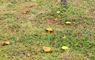 |
| We didn't know whether they were edible, so we left them! |
We had seen them beside the road, but not in the numbers we saw here.
On the highway, we crossed Gnat Pass at 4072 ft [1241m]
 |
| Gnat Pass |
and came to a marshy area at Gnat Lake, on a wide plain. We got out to take pictures, but lucky for us, didn’t see any gnats.
 |
| Gnat Lake |
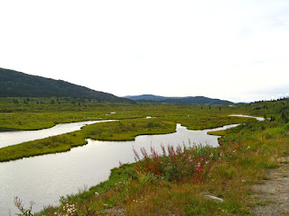 |
| Gnat Marsh |
Crossing the Stikine River,
 |
| Stikine River Bridge |
 |
| Stikine River |
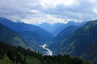
we drove down through the mountains,
 |
| A Cirque with traces of snow |
with views of the Cassiar and Skeena Mountains. As we drove further south we could see the snow-capped mountains ahead.
 |
| Snow-capped mountains ahead |
They were stunning. Some of the closer mountains just had traces of snow left. It was a beautiful drive, past lakes and mountains of all sizes.
 |
| beside laughing rivers |
We unhitched and decided to explore. First we decided to find the Meziadin Fish Ladder.
 |
| Explanations |
It wasn’t well marked, but we found it, after driving off the highway, down a narrow road. We walked down the path and found the top of the fishway above the falls. Taking another dirt road down and around a hill, we discovered the camp, and the rest of the ladder.
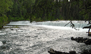 |
| Man-made falls |
We watched fish trying to jump the falls. You watch, and want to point them to the easy way, using the fish ladder!
 |
| Jumping the falls... none made the jump in the time we watched |
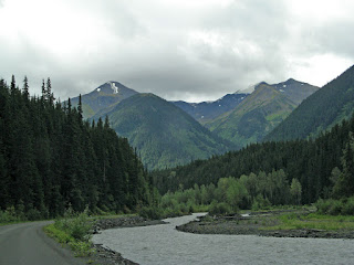
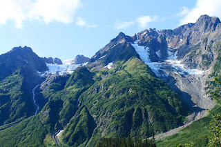
Although the weather was deteriorating, we decided to drive part way on the Stewart Highway to see what it was like. It is incredible.
 |
| Clouds sat on the mountain tops |
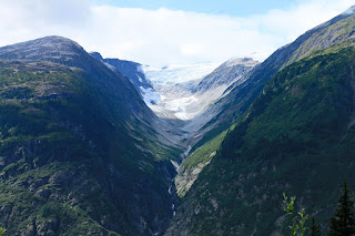
There are mountains on both sides, right down to the road. They are so high, we saw glaciers nestled near the tops.
 |
| Glaciers [seen the second day more clearly when it was sunny] |
To the north, the mountains were rugged and rocky. To the south they were higher with waterfalls tumbling down from high glaciers.
 |
| Beautiful waterfalls |
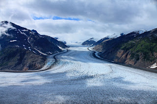
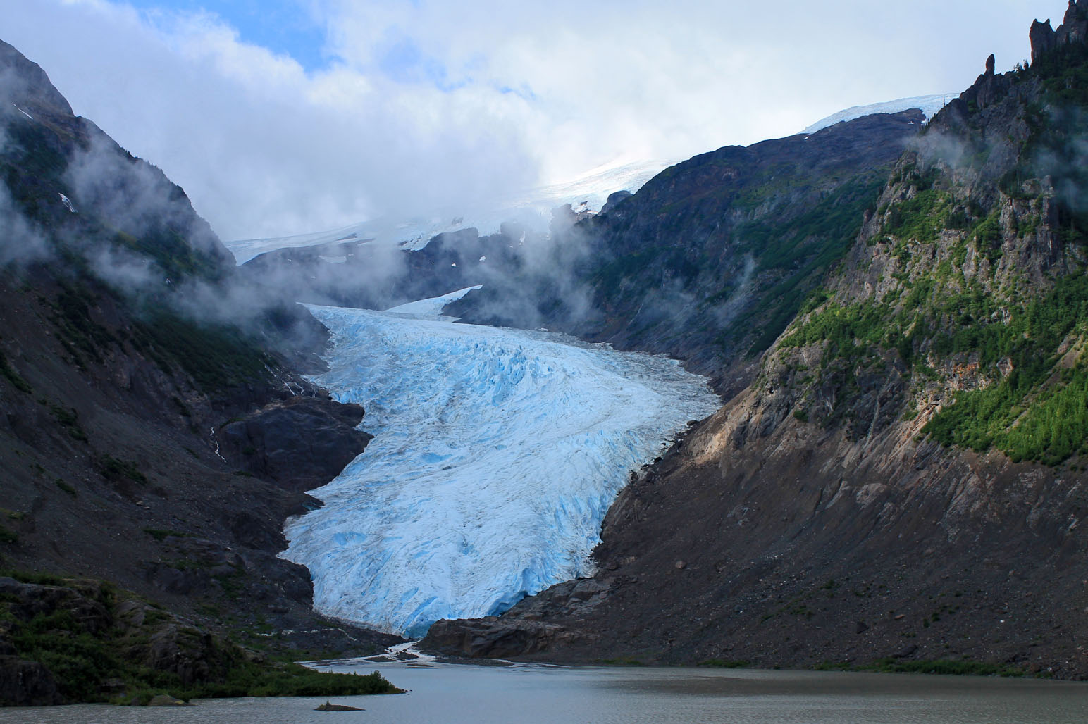
It was an incredible sight. We came around a turn and a stunning sight greeted us- Bear Glacier. The Glacier swept down the mountain from the ice fields right into the river at its foot.
 |
| Our first glimpse of Bear Glacier through the fog |
 |
| The next day and a little further along the road, a clearer view |
We parked at a pull out and stared in awe. We knew we were into a special part of the area. Since it was becoming dusk we did not go any farther, but turned around to have a campfire after dinner. The next day was clear and sunny, so we again drove down the Stewart highway. It is a spectacular drive.
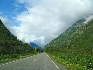 |
| Good road, good day, beautiful drive on Stewart Highway |
 |
| A clearer view of one of the glaciers high in the mountains |
Just past Bear Glacier, [we could actually see it this time], you enter the steep-walled Bear River Canyon, snaking between two mountains,
 |
| Entering Bear Canyon |
following the path of the rushing river.
 |
| View of the river as we exited the canyon |
As you exit the canyon, you come up to Avalanche gates.
 |
| and the second set of Avalanche gates |
This is not a road I'd want to be travelling in winter.
Stewart is a small town of 699 on the border with Alaska. The Visitors Info Centre is right at the beginning of an estuary boardwalk at the head of the Portland Canal, a narrow saltwater fiord,
 |
| Portland Canal |
forming the Alaska-BC border. Stewart has a deep water harbour and is Canada's most northern ice free port.
Gold and silver mining dominated the early economy. Rich silver veins were found in the Upper Salmon River Basin in 1917-18. There are the remains of the pilings of the building of original town on the tidal flats.
 |
| All that is left of parts of the original town |
From there, we drove into Hyder, U.S.A.
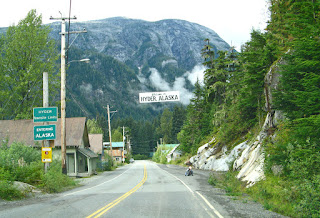 |
| Entering Hyder in U.S. |
There is no U.S. Customs, but there is a Canadian Customs when you return. Hyder is a tiny forgotten town with a population of 100. There is one store and scattered houses. We had been told, the place to have the best fish and chips ever, was "the bus", so we found it on a little back road.
 |
| The recommendation was right- excellent lunch! |
 |
| The "Rules of The Bus" |
We drove along the Salmon Glacier Road past Fish Creek, through the U.S.
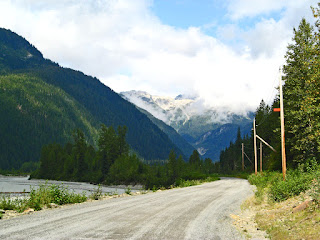 |
| Along the Stewart river- note the road! |
and back into Canada
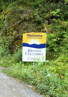 |
| Who knew? back into BC! |
on our way to the Salmon Glacier. The road started out paved, but very soon became a winding, narrow, gravel and dirt road. It climbs and winds around the mountain, past mining shacks.
 |
| A mining shack |
 |
| Interesting road! narrow, dirt, winding... |
 |
| Looking back and down at the road we drove and a mining operation |
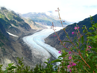
The views of the Salmon Glacier are spectacular from the summit viewpoint.
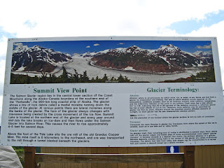 |
| The story |
 |
| John shooting Salmon Glacier |
 |
| The Toe of the Glacier story... |
 |
The Toe of Salmon Glacier
|
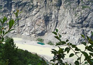 |
A "kettle" at the Toe, coloured green by the minerals
|
 |
| The week before this was a huge lake, to the right of the glacier |
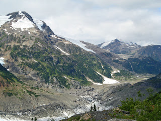
You could carry on to the active Granduc Mine
 |
| View towards the mine- look at the road here! |
or climb down to the toe of the glacier, but we chose to view it from the summit as it swept down from the Icefield.
 |
| Salmon Glacier |
The road to the mine gets even worse, more narrow and rocky. You are looking down on the glacier rather than across or up as with most of the glaciers we saw. From here there is also an incredible view back down the valley.
 |
| View back the way we had come, back down the valley |
On the way back, we stopped at Fish Creek at the salmon viewing platform.
 |
| The viewing platform along Fish Creek |
 |
| Fish Creek |
This is where everyone comes to see the bears, as the salmon are plentiful in this narrow section of the creek.
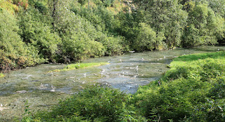 |
| Lots of salmon |
 |
| The ecosystem of the creek |
One motel in the area, guarantees seeing bears from its cabins. But of course, because we were there there were no bears. They had not seen any for a couple of days, which was unusual. We watched the salmon for a while, then left, stopped at the one store/Gift shop in Hyder,
 |
| Interesting gifts and great fudge |
 |
| Main street of Hyder |
then walked around Stewart,
 |
Empress Hotel built in 1908 as a base for the
Canadian Northeastern Railroad |
and found a little restaurant on the main street,
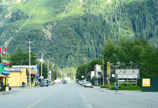 |
| Main Street of Stewart, BC |
t
o have pizza before heading back to Meziadin.
This was a lucky stop for us, as on the way back we saw 8 black bears enjoying the salad along beside the road.
At one point, all I had to do was put my arm out the window and I could have patted a mother and her cub (but I didn't). Just as we got back to the turn-off to the campground, we saw a wolf and a small black bear about 25 ft apart across the road. Unfortunately, they moved before we could get a good picture!
The next morning we were up before 6, to see if we could see the bear that we were told had been wandering around the camp each morning. But, guess what, no sign of it that morning. However, I did get pictures of the calm morning lake.
 |
| Lake Meziadin |
 |
| View from the dock at the Park looking across the bay |
Then it was time to leave and head south.


I follow your blog with great interest in preparation of our trip. Tank you.
ReplyDeleterobidouxrejean.blogspot.com