We really did not want to leave Dawson; however, the time
had come to move on. We had originally planned to go north on the Dempster Highway
up to Tombstone. However, it had been cool and wet, and the forecast for the
following week was more cold, wet weather, so we decided to go south and west
to Kluane National Park. This meant driving back down the Klondike Loop to
Whitehorse, and going west on the Alaska Highway.
So we headed south.
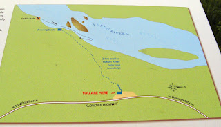
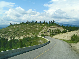
It started out sunny- of course because we were leaving! We drove right
to Twin Lakes, stopping only at Five Fingers Rapids.
These are amazing. The tall fingers of basalt stone rise up
out of the rapids, making this a dangerous section of the river to navigate for
those on their way to the gold fields. The safest passage is the near, or south
side, of the rocks. A chain was anchored to the shore above and below the rapids
allowing the sternwheelers to be winched against the swift current. We
discovered that there is a trail to the river, but we did not have the hour to
walk it.
 |
| Trail to the rapids |
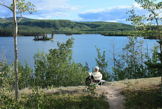
We were able to get the same site at Twin Lakes! John ended
up diagonally across the site, but at 5:30pm, there were only 3 of us in the
whole park, so we were not too concerned.
 |
| We were there early enough to read by the lake |
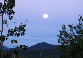 |
| 11:01 pm from the campfire |
However, by 9, it was a different story. The park was full,
and one car had driven around twice. On his 3rd pass, he stopped and
asked if we were staying longer than one night. Having been assured that we
weren’t, he put his kayak trailer in the other side to reserve it for the next
day. We ended up having a long chat with them that evening,
 |
| 12 midnight - view to the south |
and the next morning.
The next morning, another sunny day, we drove to
Whitehorse. Since it had been dry, the sections under construction were really dusty!
 |
| The truck bed, truck and trailer were a mess after this drive. |
We had been trying the cinnamon buns at several places as they had been
recommended. So Braeburn Lodge was a necessary stop. It was rather
disappointing- not as much cinnamon and quite doughy. But it was huge- easily
the size of 3 others.
We stopped at the site of the 1998 Fox Lake Burn
 |
| Fox Lake |
and walked the interpretive trail through the burn to the
lake. The devastation from these huge forest fires is heartbreaking.
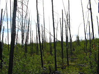 |
| Some underbrush, but no trees |
Back to stay at Hi Country RV Park in Whitehorse.
 |
| Another lovely pull-through site |
Cristina
and Paul were having a tire fixed, so we unhitched and went to see them for a
short visit before they began their trek to the NWT.
Second time in Whitehorse, but a shorter visit, meant
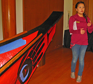
laundry was top priority. We stopped in at the Kwanlin Dun Cultural Centre
first. It is a beautiful modern building on the shore of the Yukon River.
We had a delightful guide who explained history and traditions, and
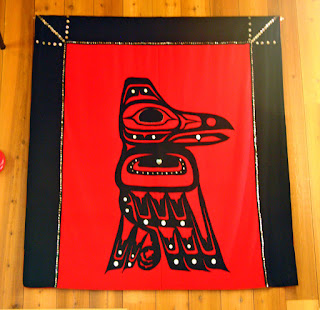
showed us some examples of the local culture and arts,
 |
| This illustrates the 2 Divisions of First Nations peoples, the Crow and The Wolf |
and some of the rooms,
 |
| Our guide, in the Reception Room, a huge Hall |
 |
| The Crow |
 |
| A Quilt Wall Hanging |
including the Long House, which was set up for a wedding,
and a large hall with a beautiful dugout canoe in it. The Kwanlin Dun originally
lived where the city is now, but were gradually moved up and then away from the
river as the city grew. This stunning Conference and Cultural Centre celebrates
their way of life and is a gathering place for people of all cultures.
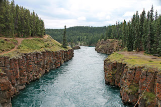
The next day we took a drive through Miles Canyon. Here the
river forms a deep narrow channel,
 |
| Miles Canyon steep walls |
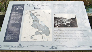 |
| The explanation for the walls of the Canyon |
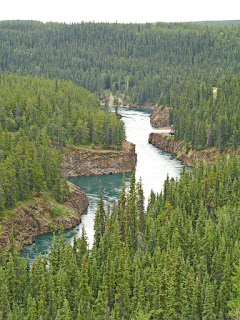 |
| Miles Canyon |
followed by the Whitehorse rapids, making it an imposing challenge for
miners on their way down the river to the gold fields. When the news of the big Klondike gold strike
reached the outside world in 1896, the rush was on! Thousands poured through
Skagway in Alaska en route to the goldfields around Dawson City. Most crossed
passes, mainly the Chilkoot Pass, and built rafts at Lake Bennett. From there
they could float to Dawson City. 7,000 were on the lake within 48 hours..
Except they had to get past Miles Canyon and the rapids. Within a few days of the arrival of thousands
of boats, over 150 were lost and 10 people drowned. Sam Steele of the NWMP
directed that a boat could only use the river with an experienced pilot. Many
people decided to portage. Norman Macaulay and John Hepburn saw an opportunity
and each built a tramway, on either side of the river, horse drawn carts on
wooden rails to move boats, rafts and supplies around the canyon and rapids.
 |
| The Tramways |
When the Close brothers from England, thought they could
make a fortune with a railway from Skagway to Dawson, they bought out the
tramways in 1899, set up a townsite in Whitehorse and celebrated the completion of their railway in July 1900.
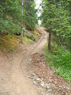
We got out to walk along the paths by the gorge,
 |
| The trails along the gorge |
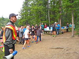
we heard cheering and clapping. The annual Trail Marathon was being run,
and this was the beginning of the last leg for the 40 relay teams, and a check
point for the full marathoners.
 |
| The hill down to the Checkpoint |
 |
| Coming in... |
 |
| Cheering the runners as they take off up the hill towards the Finish |
We watched for a while – the check-ins and exchanges. Then we
hiked for a bit, before driving to the Fish Ladder.
On the way, we saw one house on the way
where the occupants were having fun with bicycle wheels. Amazing eh!
 |
| All bicycle wheels...They are beginning to build a smaller one too |
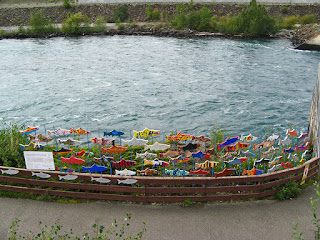
This is an interesting fish ladder.
 |
| The view from the top of the walkway to the ladder |
 |
| The dam and falls |
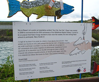 |
| The fish were a community project |
 |
| They were so successful, the school children were asked to decorate more fish |
For thousands of years,
salmon have travelled up the Yukon River to spawn in its many tributaries,
including in the headwaters near Whitehorse.
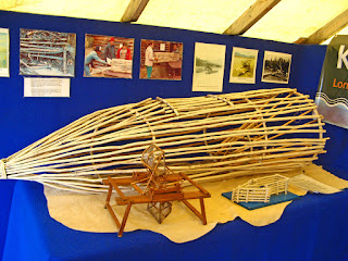 |
| A First Nations Fish Trap |
 |
| The remnants of a First Nations fish basket |
By the mid 1950’s, the Alaska
Highway and the Klondike were complete, linking many communities, the
sternwheelers which operated from Dawson City to Whitehorse had become
obsolete, and the capital had been moved from Dawson to Whitehorse. Thus
Whitehorse had grown rapidly. The Whitehorse Rapids Hydroelectric Facility was
built to meet the growing electricity demand. The Whitehorse Rapids Fishway was built to
help the ancient migration by allowing passage of the salmon around the dam.
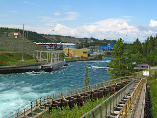 |
| The Fishway, with the Hydro-electric plant in the background |
Incidently, the building of the dam also tamed the
Whitehorse rapids, created Schwatka Lake, and raised the level of the water in
Miles Canyon.
At the end of the parking lot, we discovered another
check-point for the marathon, as they came out of the mountain towards the city
and the finish.
 |
| She is almost finished, 1 km to go! |
We then decided to drive up to the top of Grey Mountain.
 |
| View across the Yukon River of Grey Mountain |
We
couldn’t get a good look at Whitehorse because the trees had grown up at every
viewpoint. But it was quite a drive.
 |
| Coming back down Grey Mountain |
We decide to drive back into Whitehorse
and get a burrito at the Rotary Peace Park at the north end of downtown by the
river.
On to Kluane National Park and Reserve, via Alaska Highway,
west to Haines Junction. At Mile 962 [km1548] at Canyon Creek, during the
construction of the Alaska Highway, an old bridge was dismantled and a new one,
described as the most ambitious built by the US Army 18th Engineers,
was hand-built in 18 days.
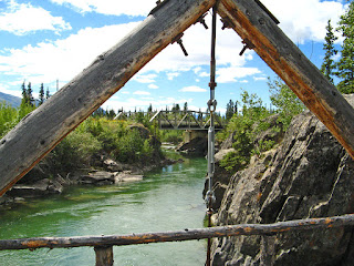 |
| View of the bridge on the highway |
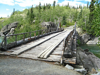 |
| It is not fit for cars or trucks, but safe to walk on |
Kluane, a
spectacular natural area, features Canada’s highest peak, Mount Logan, and the
largest icefields outside of the polar cap. Kluane National Park and Reserve,
covering 21,980 square km, [roughly the size of New Jersey] is the Yukon’s
component of the largest internationally protected area in the world and is a
UNESCO World Heritage Site. These parklands are the traditional territories of
the Southern Tuchone people, the Champagne and Aishihik First Nations and the
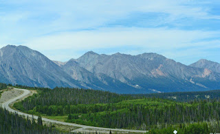
Kluane First Nation. We drove from domes,
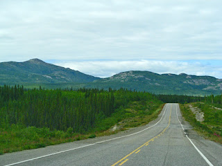 |
| The Alaska Highway West |
treed mountains
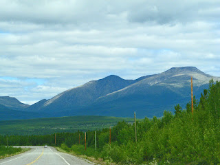 |
| Higher mountains on both sides |
to rugged peaks, and
finally to rugged peaks on both sides.
 |
| High rugged mountains in the distance |
Haines Junction is a village on the edge
of Kluane National Park and Reserve. We stopped at the Visitor Centre which is
in a beautiful building shared with the Da Ku Cultural Centre, celebrating the
culture and traditions of the Champagne and Aishihik First Nations people.
This
village is at the junction of the highway south to Haines Alaska, and the
Alaska Highway west to Tok, Alaska.
We decided to go to the national park campground on
Kathleen Lake,
 |
| On the drive down, we had just seen a lynx run across the road. |
on the road to Haines Alaska, for the first couple of days.
 |
| John had to make sure our bear spray worked! |
The
campground is very pretty, carved out of the forest, but $15.70 per night (cash
only)! Who comes up with these numbers!! We drove down to Kathleen Lake, with mountains
7-8000 ft high, right down to the water.
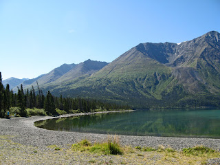 |
| King's Throne Mountain |
It was a perfect day – warm, sunny and
no haze. We walked along the right side of the lake along the boardwalk
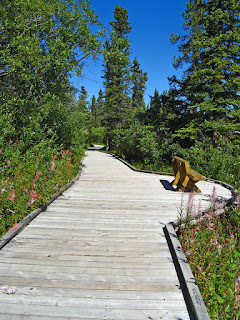 |
| Boardwalk along the lake's edge |
 |
| The fireweed are just beginning to go to seed here |
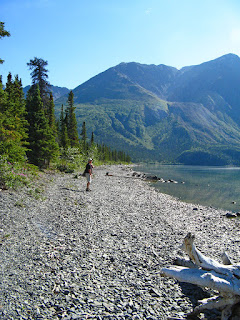
and pebbly
shore, and discovered two Red Chairs.
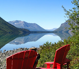 |
| It has become a game to look for the red chairs! |
The lake was calm and the view
incredible.
 |
| Amazing clear view. |
We could see the Weisshorn – a Matterhorn-type Mountain peak,
12,000 ft high- of Kluane 100 km away.
 |
| Weisshorn 100km away |
We talked to a man who was kayaking and
lived in the area, who suggested we walk along the other shore. So, we went
back and walked along the left side of the lake
 |
| The pebble beach |
 |
| A view of Mount Kennedy and Mount Hubbard |
and were able to see even
higher magnificent, snow covered mountains, Mount Kennedy and Mount Hubbard. It
was a stunning sight!
On the road again, back through Haines Junction to Kluane
Lake, the largest lake in the Yukon. We saw some evidence of the destruction of
the spruce beetle.
 |
| Many of the trees are brown from the spruce beetle |
There was still lots of Fireweed with seed pods quite red,
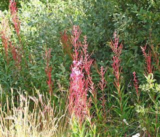 |
| Fireweed seed pods |
before they explode much like dandelions.
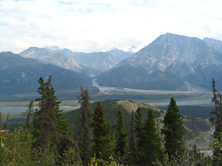
Magnificent mountains rose from the valley as we neared Kluane Lake.
 |
| The mountains were magnificent as we drove toward the lake |
The
mountains ring the lake and sweep right
into the deep blue water.
 |
| The moods of Kluane |
The stunning untamed wilderness takes your breath
away. When we reached the campground, it was a debate as to whether we would
park in the open with the water behind us, or park in a more private section.
Privacy won, as we chose a large pull through in the forest.
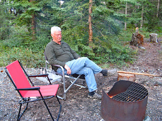 |
| ... and of course, our nightly fire with free wood! |
It turns out that
the site of this park was a poor choice- it is in prime grizzly habitat- a huge
soapberry patch, near a former local dump and with a large patch of locoweed [
the flowers are a favourite of the bears in the spring] right where the
playground was located. In May the Park had to be evacuated because the
grizzlies were mating! However, of course, we didn’t see any grizzlies.
The next day was grey and cloudy, so we drove to
Destruction Bay and Burwash Landing. It is really an area of mountain
wilderness.
 |
| rain and more rain... |
There are no homes of any kind between “towns”. It is a desolate, but beautiful drive. Destruction Bay was named when the
construction camp was destroyed by a severe windstorm while the Alaska Highway
was being built in 1942. It was one of the rest stops and with access to the
superb fishing in Kluane Lake, still a busy rest stop.
From the Parking lot is a short level trail, then it is a steady uphill climb for 5km on a wide
dirt trail,
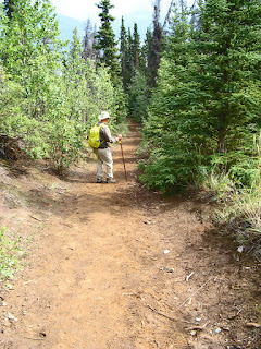 |
| A steady uphill climb |
along the side of Sheep Mountain and above Sheep Creek. It was a
beautiful climb through trees with views of Sims River Valley
 |
| View of the valley from Sheep Mountain |
and the Kashawulsh
Glacier.
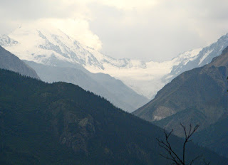 |
| We had a great view of the glacier |
It was time to leave Kluane as our days in the Yukon were
dwindling. We had one more area to see- so back to Whitehorse, and down to Carcross
and Atlin before taking the Cassiar Highway south.


