With the rain over and the sun showing more each day, we
were able to go out without the umbrellas. We went to LA Fitness
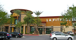 |
| One of the two LA Fitness Clubs near us |
several times
a week, to do weights, our circuits or John to cycle while I did aquafit. We
found REI and Camping World, exploring both Mesa and Tempe. We stopped in at an
RV dealer that sold Airstreams. He also showed us a Retro trailer, set up like
a 50’s kitchen. While we were still at Lost Dutchman, we went to the
Superstition Mountain Museum and Apacheland.
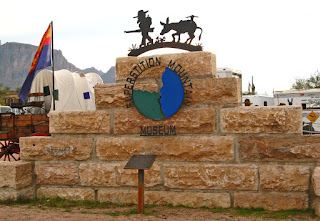 |
| The blocks are from the facade of the Roosevelt Dam |
When you first park, there is the Hee Haw Corral with a couple of Burros, for kids to ride
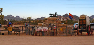 |
| The Hee Haw Corral- Burro Rides and Henny Penny |
And Henny Penny the piano-playing chicken..
The museum is very interesting,
giving an interesting and detailed pictorial description of the formation of
the Superstitions,
 |
| One of many clear diagrams of the formation of The Superstitions |
a life-size display of the wildlife,
 |
| Fauna of the Sonoran Desert |
 |
| Javelina [Havel-eena] "Don't Call Me a Pig" |
 |
| Bobcat in action |
descriptions of the early inhabitants, the building of the Apache Trail,
 |
| Building the Apache Trail |
 |
| Roosevelt City, at the foot of the dam as it was being built |
 |
| Apache Trail as the the first travellers used it |
and the early pioneers and miners,
 |
| Life as an early pioneer |
including the story and maps of the Lost Dutchman gold mine.
 |
| The entrance to Jacob Waltz's "Lost Dutchman Mine" |
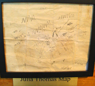 |
| One of many maps to the Mine |
There are artifacts,
 |
| Hopi Kachinas |
history
 |
| Native American groups in Arizona |
and folklore
 |
| One of many examples of the Folklore |
of the Superstition Mountain and surrounding area.
There is archeological evidence of the presence of people some 9000 years ago. There
is also a dioama which is an exact replica of the Movie Ranch Set which was
located 11 miles west of the museum in the foothills of the Superstition
Mountains.
 |
| "Apacheland" - Western Movie Location |
Originally it was built as a film location for movies and later TV
productions to capitalize on the popularity of western movies. It burned to the
ground in 1960, was painstakingly rebuilt to become one of the movie capitals
of the West, only to once more burn to the ground again in 2004. Only 2 of the
major buildings remained, the Elvis Memorial Chapel,
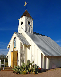 |
| The Elvis Presley Memorial Chapel |
 |
| The chapel is still used for weddings |
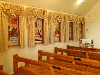 |
| Movie posters line both side walls |
 |
| The Poster for Charro, starring Elvis Presley |
an intregral part of his movie Charro,
and The Apacheland Barn, the site of many barn scenes in movies, TV productions
and TV commercials.
 |
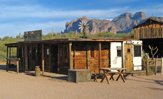
| Apacheland Barn and Blacksmith shop |
Audie
Murphy made three movies here, and it is sometimes referred to as “the Audie
Murphy barn”. Today, the Barn itself is a museum to the Motion Picture industry.
 |
| Saloon, Drug store, and daily life... |
 |
| The sign reads, "Why walk around half dead, when we can bury you for $22.50" |
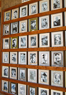 |
| There are two walls of pictures of movie stars and other movie personnel |
Both buildings were carefully taken apart and reconstructed on the
museum site. In addition, the 12-acre museum site has reproductions of 19th
century businesses, including a Wells Fargo office, jail,
 |
| Jail and Wells Fargo office |
stage coach,
 |
| Stage Coach by the Gallows |
assay
office,
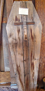
and some artifacts from the 1800's.
 |
| Water Drill |
Outside there is also a 20-Stamp Ore Mill. This is a large
mechanical device used to crush ore that contains precious metals. It uses heavy
metal stamps to pound and break apart the rock, pulverizing it so the valuable
metals can be extracted for further refining. This basic idea has been used for
thousands of years. It became an important of the mining process. This stamp
mill, built in 1914, was originally used in Bland New Mexico.
 |
| 20-Stamp Ore Mill |
You can also wander the nature walk trails which crisscross
the beautiful Sonoran Desert around the buildings. They are in the process of building a Model Railroad on the site.
 |
| Model Railroad site |
It was time to move to Usery Mountain Regional Park in the
northern part of Mesa, 21km away- our shortest move yet. This is a gorgeous,
well run Regional Park, with both camping and day-use areas. There are a lot of
programs offered for campers and for folks who pay the $6 entry fee for the
day. Some of these are run by Rangers, some by the Volunteers and some by
outside guests. In addition, there are miles of hiking trails, most of them
classed as easy or intermediate, with just two classed as difficult. One of
these is a 7.5 mile hike around Pass Mountain, and the other, which John is
going to do before we leave, is up to the Wind Cave, carved by wind erosion in
the tuff on Pass Mountain.
 |
Pass Mountain from our kitchen window.
The light band is tuff, volcanic ash welded together. |
The sites are varied, but generally very large, level,
naturally landscaped,
 |
| We are on the corner, this is from the side road |
 |
| Looking out the doorway |
and outlined with stones. Sites are well spaced, so we
hardly know we have neighbours.
 |
| These are our closest neighbours- a pack rat's midden |
Our first evening there we attended an interesting talk by
a local geology professor, A.J. Lombard, on the Geology of Arizona. He was
fascinating. We had read some of it; however, his talk and slides brought the
words to life. The Superstition Mountains are in fact a collapsed caldera of
ancient volcanoes, originally a mile deep, raised by resurgence or more recent
volcanic activity to a mile above the surrounding land. Slow uplifting and
erosion over 15 to 20 million years formed the mountain as we see it today.
before winding back down to the opposite side of the Merkle Trail.
 |
| Looking across at Cat Peaks... |
Sunday, our Airstream friends hosted a gathering of
Airstreamers who are staying at Mesa Regal RV Resort. We had a great visit,
connected with folks we had met in BC and met several new folks. Everyone share
stories about Airstreaming across the country, from being caught in
Tornado-like winds to full-timing for 30 years to having 5 Airstreams.
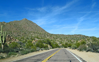
We started out to swim at LAF, but decided to drive further
along the Usery Pass Road past the Park to see what was there.
 |
| Rocky cliffs to the right and volcanic cones to the left. |
John had ridden
part way, but he was going downhill for a while and knew he would have to climb
back up, so turned around. This is another beautiful drive. The road winds
between mountains- rugged on one side and cones of volcanic debris on the
other. The cone mountains look as if they have been carefully placed in an
artistic arrangement.
We turned off on the Bush Highway to Saguaro Lake.
 |
Rocky cliffs all along the road to the right
|
 |
| Volcanic debris to left |
We
drove into the “Water Users Recreation Site” an access to the Lower Salt River,
with a beautiful view of the river and cliffs.
 |
| Lower Salt River at Water Users Recreational Site |
A little further down the road,
we came to a turnoff to Saguaro Dam, but you can only drive to the resort and
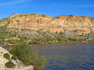
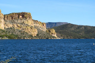
Trail Rides, so we turned around. Further on We caught a glimpse of Saguaro Lake.
 |
| Saguaro Lake and the marina |
When we got to the lake there was a Recreation Day use park, the Sheriff’s office, Saguaro
Lake Marina and a restaurant.
 |
| The Lake |
 |
| The dock for the tour boat, Desert Belle... |
 |
| Looking back up to the restaurant from the marina |
We wandered for a bit, watching the ducks
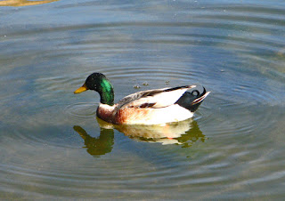 |
| A type of Mallard, we think... |
and the
serenity of the lake,
 |
A beautiful serene lake
before driving on. Just as we were about to turn around,
we spotted the Four Peaks,
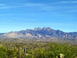 |
| Four Peaks, a popular hiking mountain in the Phoenix area |
and a sign for a Day Use area, so we drove down a
long winding road and ended up in a beautiful park, with a sandy beach. We
missed our swim, but had an interesting drive.
 |
The mountains fascinate me, they are so different, craggy and rounded...
|
|
We have one week left here at Usery Regional Park, and more
trails to walk.


