This is not a desert... this is a garden visiting Saudi Arabian Prince
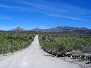
We planned our route to Organ Pipe Cactus NM, taking a shortcut to Hwy 15, a
direct route south. It went well, initially, north on I-10, the road west to was
a good 2-lane highway. However, it wasn’t long before the road began to
deteriorate, then became a dirt road
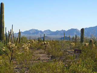
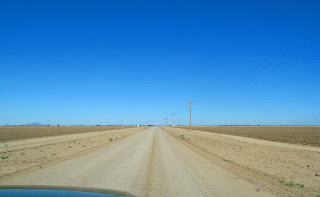 |
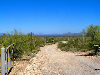
| Dirt road, supposedly to Highway 15 |
through the desert,
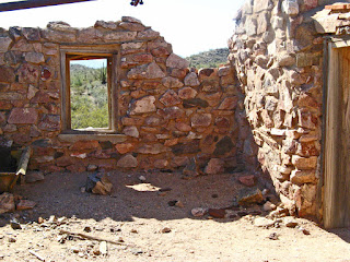
 |
| A ruin in the desert |
which quickly deteriorated too. As we drove further, sure it linked to
15, because that is what the map said, the road ended.
 |
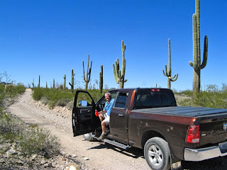
| This is not the way to the highway.... |
There was a road at the “T”, but certainly, not the
highway. So we turned around and went back to the main highway and up to I-8,
through Gila Bend. So much for short-cuts and maps! The brittle bushes along
the highways were starting to come out a beautiful yellow.
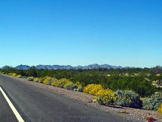 |
| Beautiful brittle bushes beside the road |
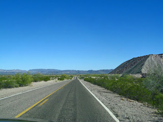
The highway went south through Gila Bend,
 |
| Gila Bend |
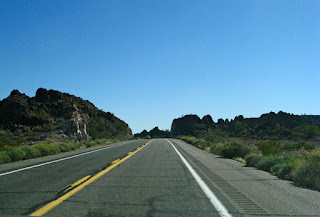
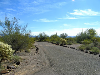
and down Highway 85 through the Barry M Goldwater
Air Force Range
 |
| The road through the Barry M. Goldwater Air Force Range |
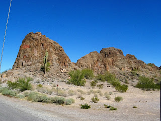
 |
| and interesting rocks, like the Badlands |
on to Ajo
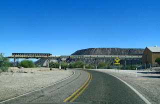 |
| The pipeline conveyor and tailings from the old copper mine |
 |
| past the tailings from the copper mine |
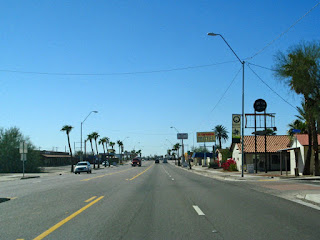
and Why,
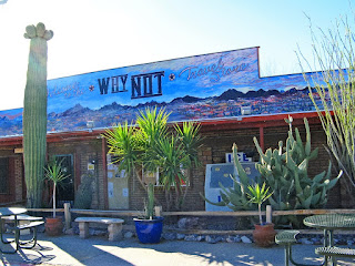 |
| The gas station and general store in Why, Arizona |
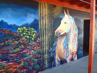 |
| They have had artists paint their washroom walls... |
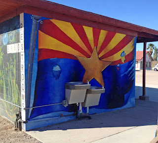 |
| and the end with the drinking fountains. |
 |
| We parked on the other side of the lot |
down to Organ Pipe Cactus National Monument.
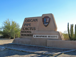 |
| The entrance to the Park |
The park was as beautiful as we remembered. Our site was a
long concrete, level pad with a concrete patio and cacti separating sites.
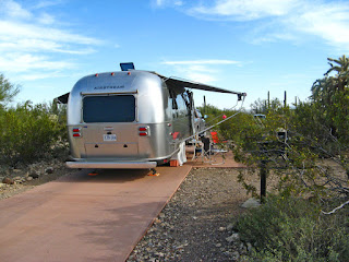 |
| Our site |
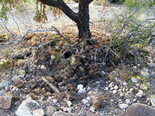 |
| with our very own midden, |
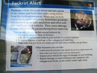 |
| and resident pack rat, who visited one evening. |
 |
| beginning of sunset from our site, |
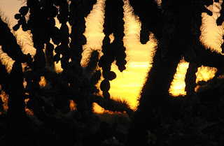 |
| and a bit later through the chain-fruit cholla by the door |
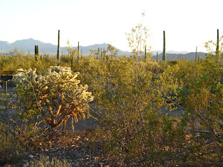 |
| cacti separating sites... |
It was in the middle of nowhere, surrounded by lush Sonoran
desert.
 |
| the campground |
 |
| good roads, carefully tended sites |
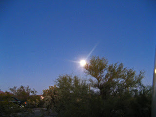
The first day was a “do nothing” day, resting because I
woke up sneezing with my face hurting – sinus. John hiked the trail up to the
Vistors’ Centre. 7 o’clock found us waiting in the group area for a ranger to
lead us on a Full Moon hike
 |
| The rising moon the first night |
 |
| Waiting for the hike to begin |
up the Valley View mountain. The moon was beautiful, and
the ranger and his assistant were excellent. Skies were clear and the
constellations were easily seen, but the scorpions were not out. We were entertained with stories of the constellations and desert facts. Interesting facts:
the Kangaroo rat doesn’t need water; the
flowers on the Organ Pipe cacti provide nectar for the bat who helps by
spreading the seeds as he flies south, and a honey trail for the hummingbirds
migrating north, and each full moon has a different name in each month.
The next morning, we were up early and at the amphitheatre
by 9 to listen to a presentation by Park Superintendent, Brent Ranger.
 |
| Superintendent Brent Ranger |
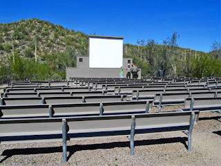 |
There was a presentation each day in the Amphitheatre,
sometimes morning, sometimes evening |
He has
been here 3 years, and is also a law-enforcement officer. He is passionate and
enthusiastic about this job, with loads of ideas for improvements for the Park.
He believes in giving a person a task and leaving it up to the employee how the
task is accomplished. He has added programs and Ranger talks at the Visitor
Centre, and twice a day a van takes you to a trailhead, so you can hike back to
the campground.
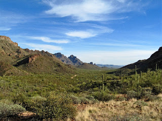
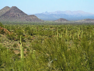
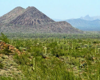
We again drove the Ajo Mountain Drive through beautiful
wilderness of the Sonoran Desert.
 |
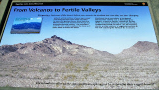
| A map of the whole Park |
 |
| Ajo Mountain Drive |
 |
| The beginning of the loop |
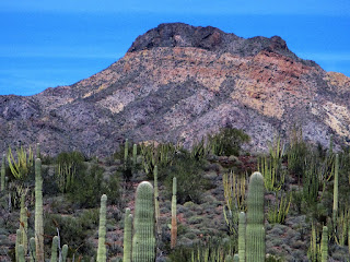 |
| Ajo Mountain |
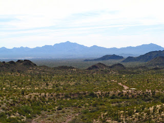
We stopped a couple of times to take pictures
down the valley,
 |
| View down the valley |
 |
| down the valley into the wash |
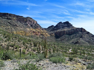 |
| toward the Ajo Mountain Range |
and walk up to Arch Canyon,
 |
| The road to Arch Canyon |
 |
| The two arches |
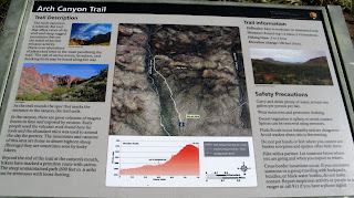 |
| Arch Canon Trail |
but only as far as the slip rock.
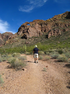 |
| The trail to the Arches |
 |
| part went through a wash... |
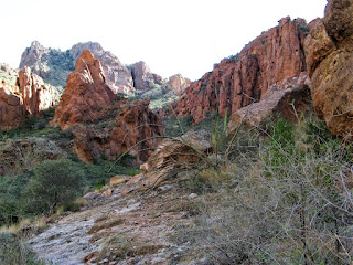 |
| the sliprock, where we stopped to the right... |
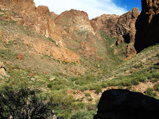 |
| The canyon to the left of where we were standing |
It
was beautiful, in a wilderness, with no one else around.
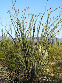 |
| Ocotillos were just beginning to bloom |
 |
| the ocotillo bloom |
 |
| Organ Pipe cacti |
 |
| The road to Estes Canyon |
We stopped at Estes
Canyon, but decided not to walk the trail. Again we found the huge Organ Pipe
cactus with the crest.
 |
| The largest organ pipe |
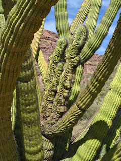 |
| The crest in the middle of the organ pipe |
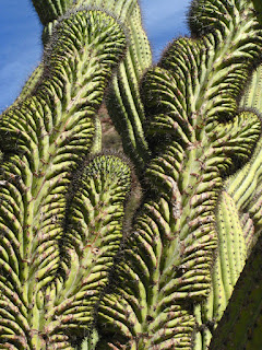 |
| It is beautiful... |
 |
| Teddy Bear Pass, on the last part of the loop |
Since I was still not feeling up to par the next day, we decided to drive
the Puerto Blanco Loop. We had driven part of this road last year, but not the
high-clearance section. This year, we drove the whole loop. We started with a
quick lunch at Pinkley Mountain.
 |
| Volcanoes Mount Pinkley |
 |
| Lunchtime... |
We drove through the gate onto the one-way
section of the loop.
 |
| note the brown sign... |
 |
| through the gate onto the one-way section... |
The views are breathtaking and we stopped to take pictures
 |
| John wanted a picture to send back to Peel... |
of
the mountains
 |
| The beautiful garden... |
 |
| down the Valley of the Ajo |
and a sensor at a wash.
 |
| A motion sensor/camera at a wash |
As we looked toward the mountains, we saw
movement; however, there were no trails on that side of the road. John got the
binoculars and I zoomed the camera in to see 4 smugglers headed north.
 |
| Look carefully at the bottom right ... |
Near the end of the loop, we saw a sign for Quitobaquito.
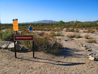 |
| Quintobaquinto and an obvious path to follow... |
We followed the path winding along by the Mexican border to an oasis in the
middle of the desert,
 |
| An oasis in the desert |
surrounded by rushes and inhabited by coots.
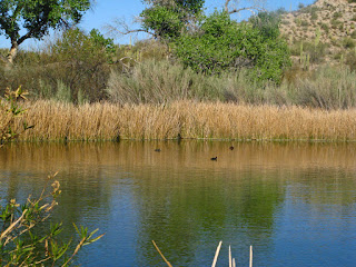 |
| Calm and serene, enjoyed by the coots |
The bottom section of the drive, runs along the border, some sections with just a double fence,
 |
| Here, the objective is to keep vehicles out, not necessarily people |
others with Normandy barriers,
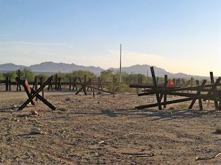 |
| These are put where the vehicles were blasting through |
and of course the wall.
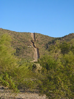 |
| The wall runs for several miles on either side of the border crossing |
As we were
driving back, a bobcat ran across in front of the car. The signs had warned us there
was wildlife in the area – we were
lucky, we saw 4 smugglers and a bobcat!
 |
| The border crossing at the end of Highway 85 |
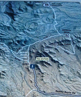
The next day we were booked on the van to the Senita Valley
Trailhead, so we were up bright and early, to meet the van at 8:45.
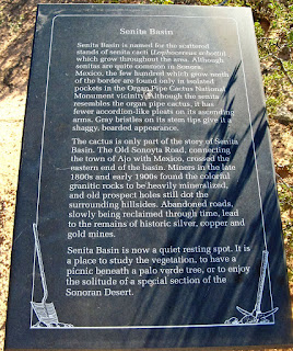 |
| Senita basin... |
 |
| Our route- easy to the Victoria Mine... |
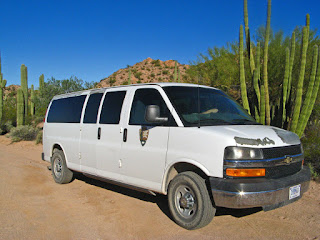 |
| Our van dropped us at the trailhead |
This hike
starts with a walk on a wide sandy path through the Senita Valley. We walked the first section with a couple from Orillia, formerly from TO.
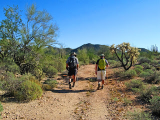 |
| an easy flat walk to start |
It was a pleasant walk through the
valley, but we didn’t see many senitas, and none near the path. These are like organ pipe cacti, but have only 6 ribs or pleats
 |
| Senita- this is at the Visitor Centre, as there wasn't one close to the trail! |
rather than the multiple
pleats seen on the Organ Pipe. This is the northernmost group of senitas, as they do not tolerate cold. They are generally found in Mexico.
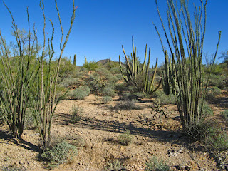 |
| Ocotillas leafing, but not flowering yet |
 |
| organ pipe cacti, saguaros, bursage bushes, and |
 |
| vehicle lost parts, |
 |
| and along narrower washes |
First we took the fork towards the Victoria Mine,
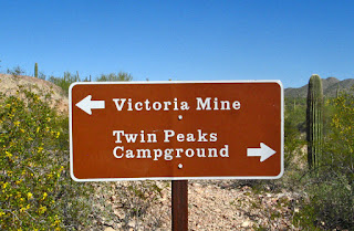 |
| The route was well marked. |
an
abandoned mine site. There are the ruins of the mine store
 |
| Mine store |
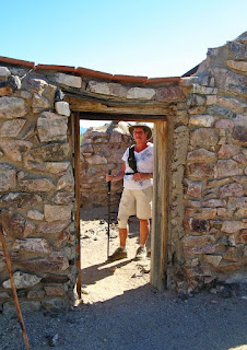 |
| I made it this far with ease... |
and several
mineshafts, covered over.
 |
| Mining |
Most of them are blocked; however, one has been left
open for the bats to use as day roosting, rearing their young during summer and
hibernating during winter.
 |
| The mine property overlooked the Senita Basin |
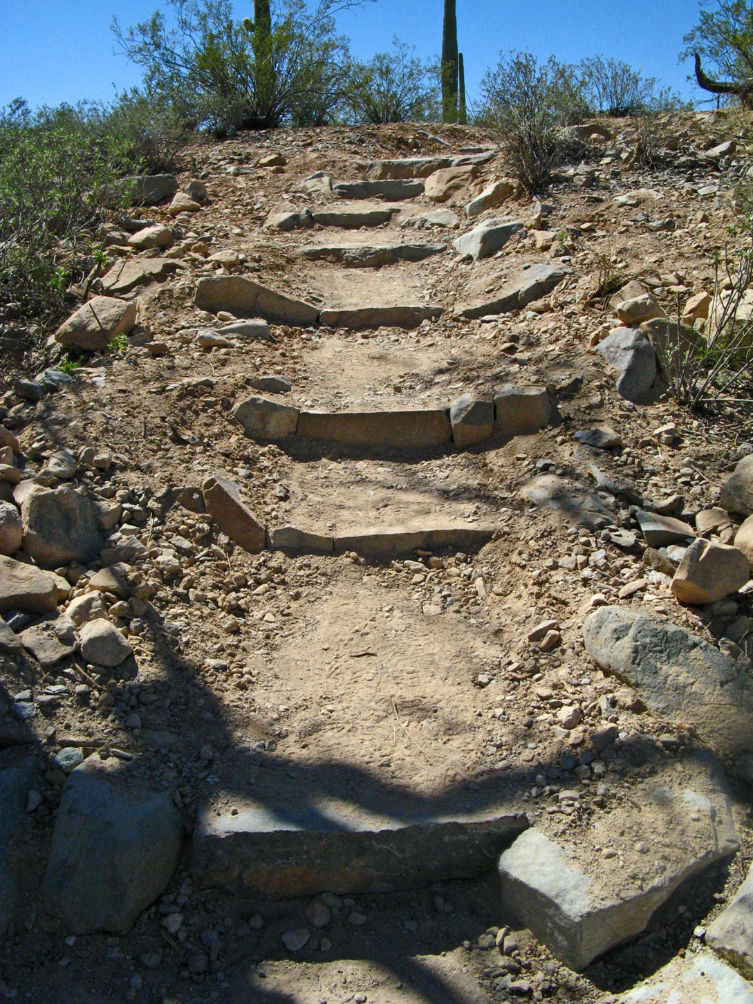
The last 2.5 miles back to our site was down to a wash
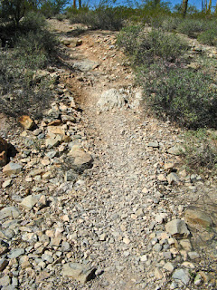 |
| not steep, but constant down and back up |
and
up the other side probably 8 to 10 times.
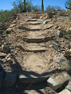 |
| The last climb had stairs, so was considerably easier, but still UP. |
None of them were really steep, but constant
and in the heat of the day, with temperatures climbing up to high 80’s, I
started to fade in the last mile, but I made it. I flaked out the rest of the
day, but was rejuvenated enough for Happy Hour with the Ontario contingent at
Jane and Henry’s RV.
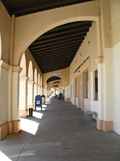
We had seen the historic plaza in Ajo, and originally were
going to stop on our way out. However, we decided to stay at Organ Pipe Cactus NM an
extra day, and take a trip into Ajo. We walked to the Historic square
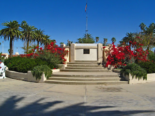 |
| The top, by the road |
and around
the historic plaza.
 |
| The end of the Plaza- the Train Station, now the Visitors' Centre |
 |
| to the left, including the Post Office, a restaurant ... |
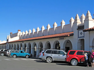 |
| to the right - a library, art gallery, market. |
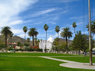 |
| Looking toward the highway, from the centre of the Park |
The architecture is beautiful.
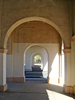 |
| The arches by the train station |
 |
| the side arches from the Post Office |
We had lunch at the Oasis Café in the plaza. I had an
excellent BLT and John had an interesting ‘beef’ sandwich called It’s not Philly.
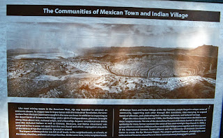
We found a pamphlet for
a walking tour around Ajo, so decided that was a great way to see the town and
learn about it. The tour begins around the corner from the Plaza at a small
park with a wall called The Memory
Project.
 |
| The explanation... |
There are pictures, memories and a mosaic quilt
 |
| a mosaic quilt |
showing the
history of Mexican Town, Indian Village
 |
| The Ajo township |
and other sections of Ajo Township as a
‘company town’, where everything revolved around the company from stores to
hospitals to housing.
 |
| A Company town |
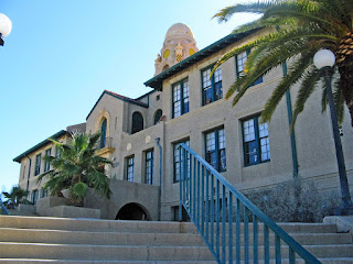
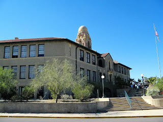
The walk continues up a street with beautiful homes,
to the
old Curley School, built in 1919.
This is a beautiful building which now
houses thirty artists and their studios.
 |
| Walking up to the front door |
 |
| Thr front door, with the wise old owl above |
 |
| A beautiful building, especially the bell tower |
The walk back down a street with
historic homes
 |
| The median of the street had beautiful cacti |
 |
| Older homes |
 |
| from several periods of the town's history |
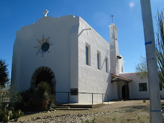
to the two historic white churches on the main street, a Catholic
church
 |
| Catholic Church |
and a Federated Church.
 |
| The Federated Church |
 |
| beautiful buildings |
We then decided to drive up to the mine lookout. You can
look right down in the open pit copper mine.
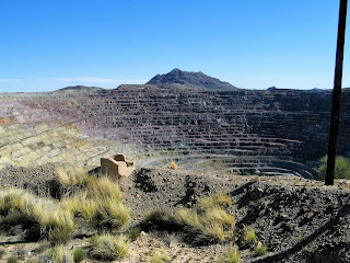 |
| Open pit copper mine |
On the way back to the park, I spotted the crested or
cristated Saguaro. The growing tip
occasionally produces a fan-like form which is referred to as crested or
cristate.
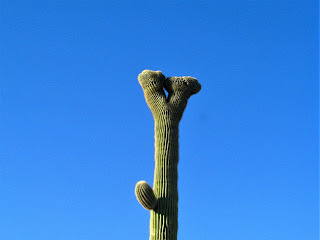 |
| Crested or Cristate Saguaro |
Our last day, John hiked up the Red Tanks Tinaja Trail, and
parts of the Baker Mine and Senita Basin Trails. I read and just hung out. At
the Tinaja, a pool in the desert, there are swarms of Africanized Honey Bees,
so he didn’t go to the bottom, but looked from afar!
 |
The wash, and rock ledge where there is a small waterfall
into the Tinaja at the bottom- when there is water... |
 |
| and deeper wash, where it flows on... |
 |
| Our last night, another magnificent sunset... |
Then we got ready to travel again!
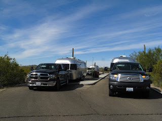 |
The necessary 'dumping of tanks, after 8 days-
three of the Airstreams left at the same time. |
 |
| We went out of the Campground, |
 |
| out of the Park, |
 |
| back passed the 'badlands', |
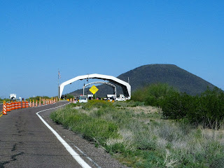 |
| and through the second Border Patrol checkpoint. |
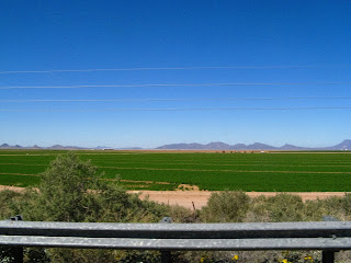 |
| Back up on I-8, passed irrigated fields, |
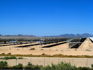 |
| huge solar projects, |
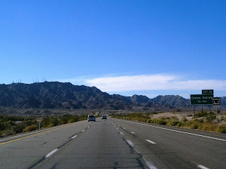 |
| and into Dome Valley, |
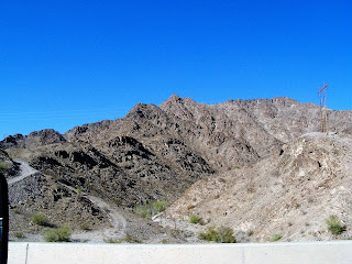 |
| Climbing through the barren rocks, |
 |
| to the fields just outside Yuma |
 |
| and unique bridge, |
 |
| passed the Casino and mission, |
 |
| and many RV 'Resorts'. |
We stopped at the Quechan
Casino
for the night along with 50 plus other RV’s.
 |
| RV Park at the casino |
It now costs $10 for 3
nights, [we had to pay it for just one night], but security is good and so generally was the
food. Once you pick up your Players Card, a roast beef dinner cost $11.99 each-
perfectly cooked too!
After breakfast in the casino the next day [don’t order the
eggs benedict leathery English muffin and overcooked ham-], and coffee by the pool,
 |
| The beautiful pool at the casino |
we headed “home“ to
Santee Lakes.


No comments:
Post a Comment